We research property history to determine the pavement age so, when used with the Pavement Condition Index, we can make predictions of future conditions. To do this we use aerial photographs starting with Google Earth Pro. Earth usually has photographs dating back to about 1990. Metropolitan areas may have older photos, for example, Chicago has aerials dating back to 1984. To go back further, we use a website called Historical Aerials.
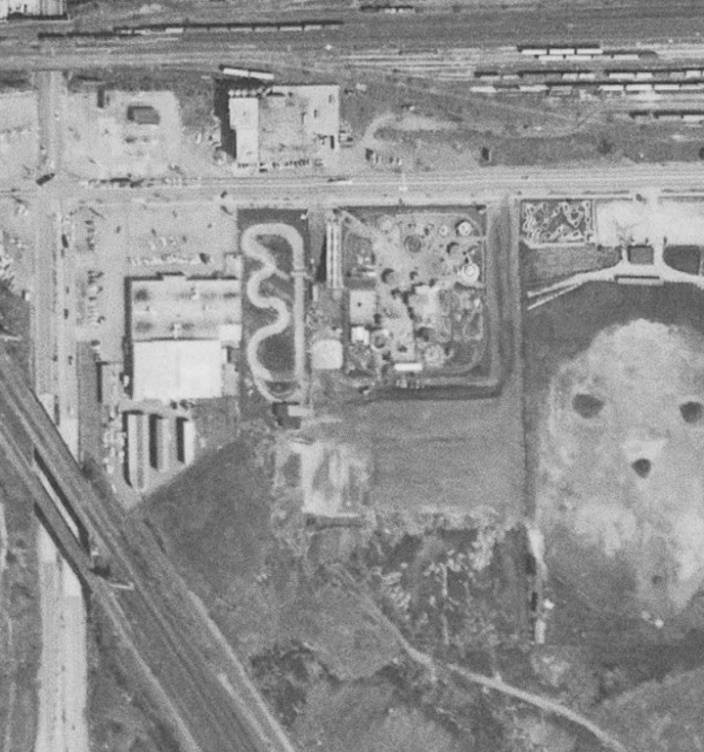
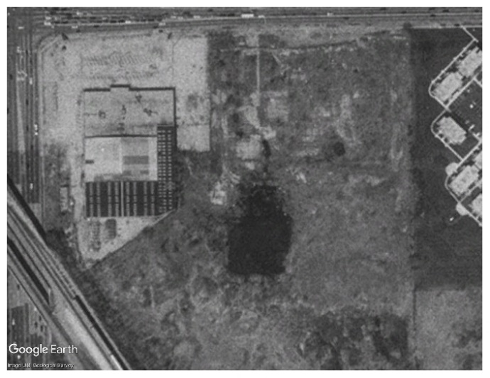
These images are an example of what we would look at to help determine pavement age and history. Examining aerials for a small grocery-anchored center found the site had an earlier life as an amusement park (left). Later it was demolished (middle).
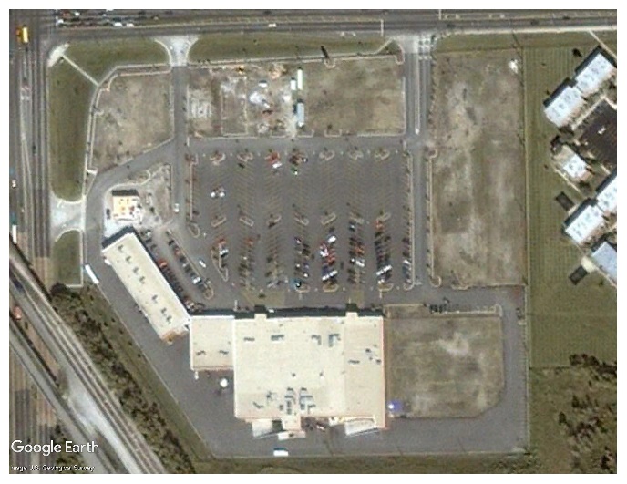
Typically, there is undeveloped land we review for features such as creeks and ponds which may affect pavement performance. For example, there is a dark spot in the middle aerial which represents a body of standing water. Looking at the right aerial, the grocery building is on that exact spot. If not properly accounted for with additional drainage features or additional pavement structure thickness, pavement performance could be adversely affected by weak soils resulting in standing water and pavement structural failure.
The difference between the left and right photographs tell us that the property was developed in phases over several years. Also, on more recent photographs, we look for changes in pavement color (light to dark) to determine when a new surface may have been placed.
Images from www.historicalaerials.com and Google Earth Pro